Namma Karnataka Drone Landscapes: Aerial Views of the Coast
There is an entirely different world visible when you take the camera to the clouds. I use my drone to document the intricate waterways, quiet backwaters, and hidden coastlines of Karnataka that most people miss.
An aerial view of the fertile banks of the Aghanashini River in Uttara Kannada. This lifeline of the region originates in Sirsi and journeys 124 km to the Arabian Sea.
A hidden spot in Kumta, known only to locals. Beyond its famous beaches, the area where the Aghanashini river snakes through villages offers unique sights of salt making and marine activities.
Coastal places are often just associated with beaches, but an aerial perspective reveals so much more. Here are the backwaters and lush mangrove forests around Udupi.
Another perspective of the green backwaters near Udupi. The drone reveals the intricate network of water channels and the vibrant landscape of the coastal region.
The Haladi river winds through a dense forest near Udupi. This aerial view captures the untouched beauty of the coastal region's river systems.
The stunning coastline of beautiful Tulunadu at sunset. This drone shot captures the unique geography where the river meets the sea, creating a beautiful natural barrier.
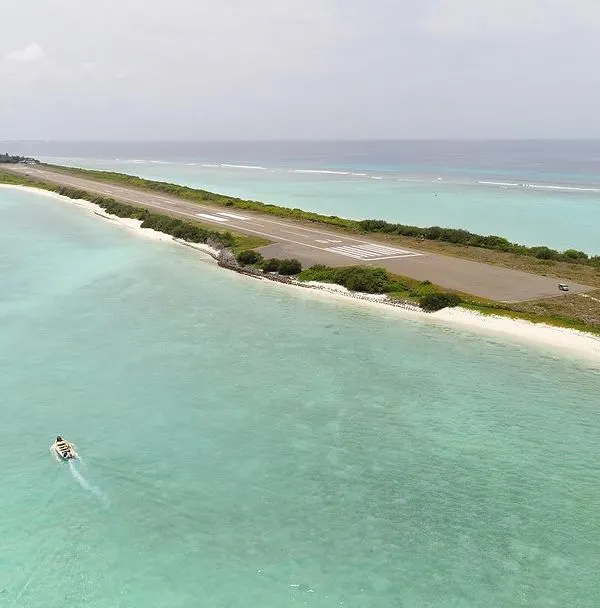
An aerial view of the Karavali coast, showcasing the serene beauty of the shoreline where lush greenery meets the vast expanse of the Arabian Sea.
An aerial shot of a shipwreck off the coast of Padubidri. This blue flag beach holds a surprising piece of history, now a point of interest for visitors.
A closer look at the shipwreck at Padubidri beach during a beautiful sunset. The warm light brings out the colors and textures of the rusted vessel against the sand.
Have you visited this shipwreck at Padubidri beach? This drone footage gives you a top-down view of the vessel resting on the shore.
About Namma Karnataka From Above: Drone Landscapes
Drone photography is more about flight planning and weather analysis than just hitting the shutter button. I map out every flight path, considering wind speed and tidal patterns before the drone even leaves the ground to ensure the final frame reveals the geometry of the landscape, not just a generic view.
Ground-level photography gives you intimacy, but aerial photography gives you context. My drone work across Karnataka is driven by a desire to show how rivers, forests, and human settlements actually interact.
Take the Aghanashini river near Kumta. From the ground, it is a river. From the air, you see the entire life cycle of the region, from the salt pans to the mangrove clusters. These are the patterns I look for. I focus on locations where the geography creates a unique story, like the shipwreck at Padubidri beach. That rusted vessel resting on the sand looks entirely different when framed against the vast, blue expanse of the Arabian Sea.
When I fly over the backwaters of Udupi or the Suvarna river, I am not looking for the perfect tourist postcard. I am looking for the lines, the textures of the paddy fields, and the way the river curves through the dense greenery. It is about understanding the land. I share these perspectives because they reveal a side of our state that is often hidden by the typical roadside view.
Similar work from other experts
Browse through Curated picks from other experts on mytribe
Aerial Cinematography of Karnataka's Rivers and Dams
Coastal Karnataka: Aerial Stories from Malpe to Mangalore
Coastal & River Aerial Cinematography
Incredible India: Aerial FPV Perspectives
India's Diverse Landscapes: Aerial Stories Captured from Above
 5
5
Coastal & Island Aerial Videography
Not what you were looking for?
Search for specific photography services or locations across Karnataka.
More from Photography Tours & Workshops by Pratap J
More services by Pratap J