Aerial Cinematography of Karnataka's Rivers and Dams
I chase the pulse of Karnataka's rivers, backwaters, and dams from the sky. This is my jivanada hudukata—a search for life—captured from above.
A before and after aerial comparison of the Gajanur Dam near Shivamogga, showing the Tunga river in summer versus the powerful flow during monsoon. This highlights the seasonal changes I document.
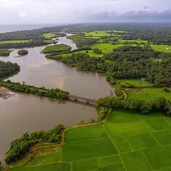
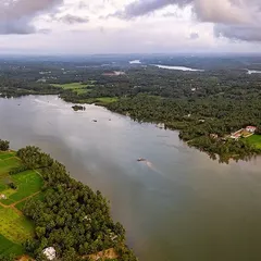
A wide aerial shot of the Kaveri river, showing its expanse and the surrounding green landscape. This footage is a tribute to the lifeline of Southern Karnataka.
An early morning drone flight over the Kali River in Dandeli. The fog rising from the water creates a mystical and serene atmosphere, perfect for capturing the calm beauty of the backwaters.
An aerial view of the Jungle Lodges & Resorts property nestled by the Kabini backwaters. This shot is ideal for hospitality and tourism clients, showcasing the property's stunning location.
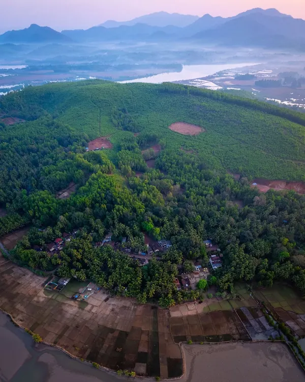
A beautiful sunset aerial view over the fields and waterways of Mandya district. The warm light and patchwork of colors show the beauty of Karnataka's agricultural heartland.
A stunning sunset over the Bengaluru cityscape. The sun's rays pierce through the clouds, illuminating the urban sprawl in a dramatic display of light.
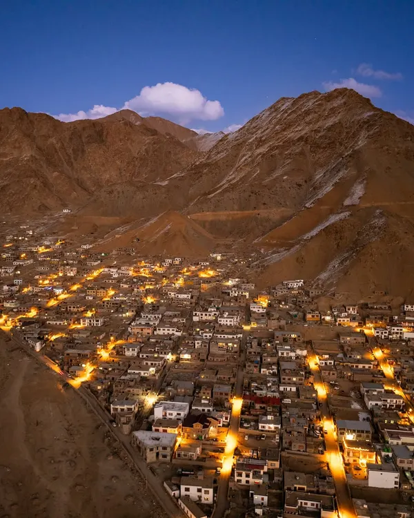
A high-altitude drone shot revealing the vast expanse of Bengaluru city. This gives a sense of the scale of the city from a perspective few get to see.
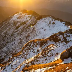
A breathtaking view from Nandi Hills, showing a sea of clouds blanketing the landscape below. This is a classic Bangalore experience, captured from a unique aerial vantage point.
A timelapse video of the sunset, captured by drone. This technique shows the movement of the clouds and the changing colors of the sky in a condensed, beautiful sequence.
An abstract aerial shot flying through clouds during sunrise. The beautiful colors and textures create a dreamlike and artistic visual.
About Waters of Life: Rivers, Dams & Landscapes
My drone setups for water bodies vary based on the time of day—I prefer shooting during the golden hour to catch the light hitting the surface, which often means I am on location well before sunrise. Whether it is the moody, misty fog over the Kali river or the heavy monsoon flow at Gajanur Dam, the weather dictates the flight. If you have a specific location in mind, let me know the timing, and I can suggest the best window to fly to capture the water at its most dramatic.
Capturing the Soul of Water
Water is never static. It reflects the sky, changes with the seasons, and tells a story of the land it flows through. When I shoot at places like the Gajanur Dam or the backwaters in Dandeli, I am not just flying; I am looking for the pattern of the flow and how the local geography interacts with the weather. I use my Mavic and Phantom series drones for stable 4K footage that truly shows the scale of these landscapes, ensuring the clarity needed for professional projects.
My Approach to Landscape Cinematography
- Terrain & Weather: I am experienced with the unpredictable nature of our ghats and coastal areas. I don't fly in heavy rain, but I love capturing the drama of a storm passing over the water.
- Locations: I travel across the state—from the Mandya paddy fields to the hidden corners of the Western Ghats. If the project is right, I will go where the water takes me.
- The Deliverables: For landscape and dam cinematography, high-quality RAW footage is essential. I deliver all usable, uncut footage so you can color grade it to match your specific vision, along with a 30-60 second edited highlight reel.
Common Questions
Can you shoot in low light? Yes, my gear is capable of low-light and twilight shooting. The reflection of the sun on the water during these times often provides the most cinematic results.
Do you handle the travel logistics? I am an Alemari—I am used to the road. Whether it is a resort near Kabini or a distant dam project, I manage my own travel arrangements. We just need to finalize the dates.
What if the weather is bad? Safety is first. If the wind or mist is too heavy, we wait. I prefer to keep a buffer day in my schedule for these shoots to ensure we get the right shot, not just any shot.
Similar work from other experts
Browse through Curated picks from other experts on mytribe
Coastal & River Aerial Cinematography
Aerial Waterfall Films of Karnataka
 28
28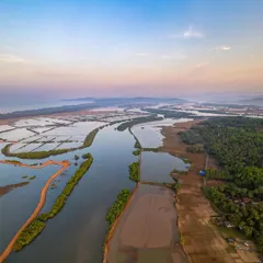
Namma Karnataka Drone Landscapes: Aerial Views of the Coast
 4
4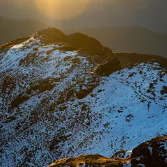
High-Altitude Aerial Photography for Mountains and Valleys
India's Diverse Landscapes: Aerial Stories Captured from Above
Incredible India: Aerial FPV Perspectives
Looking for a specific view or location?
Search for a landmark, river, or region to see if I have flown there.
More from Aerial & FPV Drone Videography by Puneeth
More services by Puneeth