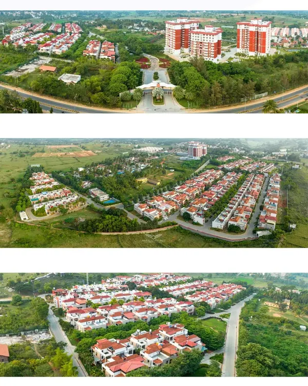
Aerial & Masterplan 3D Visualizations
Transform your project blueprints into photorealistic aerial perspectives. We render large-scale developments, townships, and coastal resorts, helping you visualize the site layout and its surroundings in high-fidelity detail.
An aerial 3D visualization of a sprawling coastal villa community and marina. This bird's-eye view captures the full scope of the development, including the layout of the residences, the poolside amenities, and the arrangement of boats in the harbor, providing a comprehensive overview for potential investors.
A large-scale aerial view of a massive residential development integrated with a golf course. This rendering is crucial for demonstrating the master plan and the vast green spaces associated with the project.
A bird's-eye view of a dense, green residential complex. This image highlights the use of rooftop gardens and lush corridors between buildings, emphasizing a commitment to sustainable design.
A wide aerial shot of a coastal resort, showing the entire property from the tennis courts and residential blocks to the marina and surrounding ocean.
A 3D rendering depicting a large coastal city skyline. This type of visualization is used for urban planning and demonstrating the potential impact of new developments on a city scale.
An aerial view of a commercial high-street development at dusk. This perspective shows the layout of the retail buildings, pedestrian zones, and the flow of evening activity.
An aerial rendering of a mid-rise apartment complex, showing the building's footprint, rooftop amenities, and proximity to a river and green spaces.
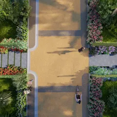
A top-down view of the apartment complex's rooftop, detailing the layout of the running track, green roofs, and recreational areas for residents.
A night-time aerial view of the coastal marina development. The illuminated buildings, streets, and docks create a stunning visual that highlights the vibrant nightlife of the community.
A close-up aerial view of the marina and beach club area, showing the pool, docked boats, and the lively atmosphere of the waterfront.
About Aerial & Masterplan Visualizations
When pitching a large-scale project, a bird's-eye view does more than show the footprint; it proves viability. We model the entire context—roads, greenery, and adjacent infrastructure—to show exactly how the project sits within the existing landscape. Our rendering process ensures that even at this scale, textures and lighting remain sharp, giving stakeholders a clear, realistic understanding of the project flow before construction begins.
Why Aerial Visualization Matters
For developers and urban planners, an aerial masterplan is the ultimate sales tool. It allows potential investors to grasp the relationship between the built structure and the natural environment. We use advanced V-Ray and Corona rendering engines to handle complex site geometry, ensuring that even large townships with thousands of units are rendered with clarity.
Our Technical Approach
- Contextual Modeling: We do not just render the buildings. We include surrounding city infrastructure, access roads, and green belts to anchor the project in reality.
- High-Fidelity Assets: Our extensive library of 3D vegetation and urban elements ensures the landscaping looks lush and natural, not sparse or artificial.
- Lighting Control: Whether you need a bright, sunny daytime look to emphasize greenery or a dramatic dusk view to showcase amenity lighting, we tailor the atmosphere to your brand's narrative.
- Resolution & Detail: We deliver 5K+ Ultra HD renders, ensuring that fine details—like pavement markings, swimming pools, and rooftop gardens—are crisp enough for large-format hoarding prints or digital brochures.
From residential gated communities to high-rise commercial hubs, we help you translate 2D CAD files into compelling visual stories that stand out in the market.
Similar work from other experts
Browse through Curated picks from other experts on mytribe
 8
8

Residential Real Estate Aerial Photography
 15
15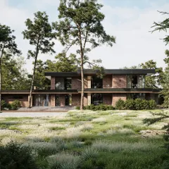
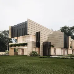
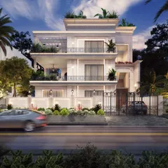
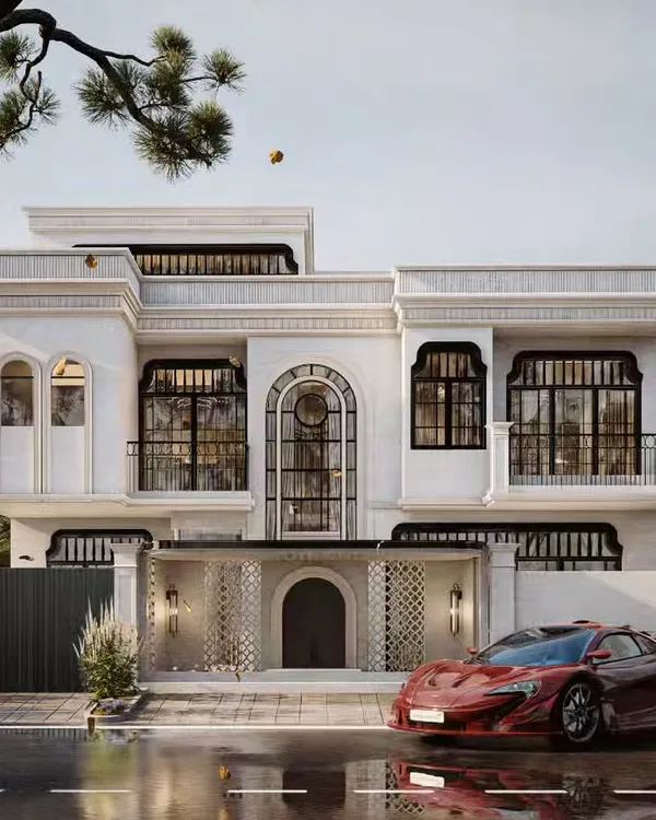
Photorealistic Exterior Architectural Renderings
Conceptual Landscape Designs & 3D Visualizations in Bangalore
 5
5
Realistic 3D Architectural Exterior Renders & Visualization
Professional Architectural Plans & 3D Visualization
 4
4
Architectural Concepts & 3D Visualization Services
Explore other architectural visualization services
Need a different perspective? Browse our other 3D rendering styles.
More from Architectural 3D Rendering by Avenir Design Studio
More services by Avenir Design Studio