Aerial Architectural & Landscape Drone Photography
From the geometric perfection of historic monuments to the raw patterns of the landscape, I use my drone to reveal stories hidden in plain sight.
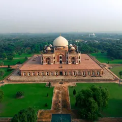
This cinematic drone video of Humayun's Tomb reveals the perfect Mughal architecture and charbagh garden layout. The smooth, flowing shots demonstrate my style of using motion to explore the symmetry and grandeur of historical sites, a service ideal for heritage and tourism projects.
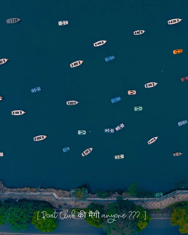
A top-down aerial shot of the shoreline of Naukuchiatal, contrasting the deep green water with the lush forest and houses. A lone boat adds a sense of scale and tranquility to this beautiful Uttarakhand landscape.
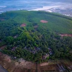
This high-altitude drone photo reveals the terraced farming and winding roads of the hills surrounding Naukuchiatal. It showcases the patterns of human settlement within the vast natural landscape of the Kumaon region.
A minimalist top-down view of two boats on the emerald green waters of Naukuchiatal. The simplicity of the composition highlights the peacefulness of the lake and the subtle textures on the water's surface.
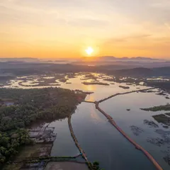
A wide aerial photograph of Naukuchiatal, capturing the lake nestled within the Himalayan foothills of Uttarakhand. This shot showcases my landscape photography service, perfect for highlighting the natural beauty of travel destinations or real estate properties from a breathtaking perspective.
About Architectural Symmetry & Natural Landscapes
The value of aerial imagery lies in the geometry you cannot see from the ground. Whether it is the perfect charbagh layout of a heritage site or the winding roads of a mountain village, I focus on capturing these top-down perspectives that turn architecture into art. I use DJI equipment that supports true vertical shooting, ensuring your final files are ready for social media or professional portfolios without losing resolution to cropping.
Ground-level photography provides context, but the sky provides the full picture. When I shoot architecture, my priority is identifying the symmetry that defines a structure. For historical sites like Humayun's Tomb, I use specific orbit and top-down flight paths to highlight the architectural planning that remains invisible to a passing visitor. This approach is highly effective for heritage documentation and property showcase reels.
For natural landscapes, such as the lakes in Naukuchiatal, the challenge is scale. I look for the patterns created by human settlement against the backdrop of the hills. My drone work involves mapping these environments to ensure the composition captures the relationship between the built world and nature. I rely on cinematic motion—slow, steady flyovers—rather than fast, jittery movements. This technique results in footage that feels grounded and professional.
My workflow includes a pre-shoot digital site survey to account for sun direction and flight paths, ensuring the best lighting during the golden and blue hours. For event or property clients, I deliver a mix of HDR photography for detail and high-quality 4K video for cinematic storytelling. If you have a specific project that requires a bird's eye perspective, let's discuss how we can map it from the air.
Similar work from other experts
Browse through Curated picks from other experts on mytribe
 63
63
Aerial Drone Photography for Landscape Projects
 9
9Cinematic Aerial Perspectives & Drone Cinematography
Professional Drone Photography and Cinematic Aerial Videography
Cinematic Drone Photography and Aerial Cinematography
Sacred Architecture From Above
 20
20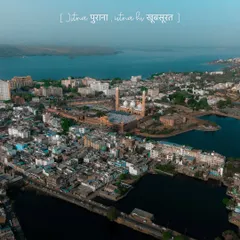
Cinematic Drone Cinematography & Aerial Videography
Looking for a different aerial perspective?
Use the search bar below to find specific drone photography services or themes.
More from Drone Photography & Videography by Akshansh Kumar
More services by Akshansh Kumar