Urban Landscape & Infrastructure Drone Videography
I capture the rhythm of our cities and the scale of our infrastructure. From the flow of traffic in Delhi to the layout of major railway stations, I provide a perspective that ground-level photography just misses.
A smooth aerial shot following a flyover at night. The lighting on the pillars and the flow of traffic create a visually compelling video that's perfect for showcasing urban development and infrastructure.
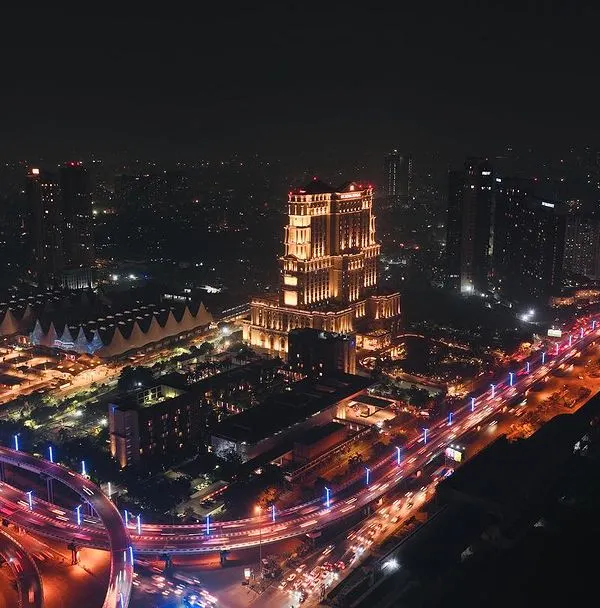
This is a long-exposure aerial photograph taken with my DJI Air 3. It transforms city traffic into vibrant trails of light, a creative technique to capture the energy of the urban environment at night.
A daytime aerial view of a busy traffic circle in Delhi. This kind of footage is valuable for traffic analysis, urban planning, or simply capturing the bustling character of a city.
An aerial overview of the Rafiganj Railway Station. This demonstrates my ability to capture large infrastructure projects, showing the station's layout, tracks, and its integration with the surrounding town.
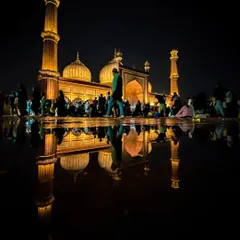
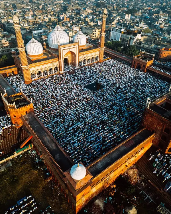
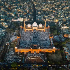
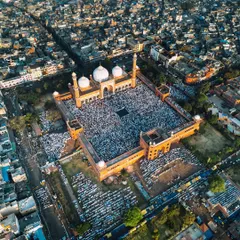
Capturing the historic Jama Masjid in Delhi on August 15th. This footage showcases the monument's architectural beauty from day to night and its significance as a gathering place, all from a unique aerial perspective.
A beautiful sunset over the city of Udaipur. This wide shot captures the city's density, the adjacent lake, and the stunning colors of the sky, creating an atmospheric cityscape.
A quiet, moody shot of a city skyline just after sunset. This type of atmospheric footage can be used to set a tone or convey a sense of calm within a bustling urban environment.
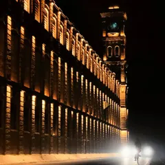
This night shot follows a major highway, capturing the constant flow of traffic. It's another example of how I use my drones to film dynamic scenes in low-light conditions.
About Urban Landscapes & Infrastructure
For urban and infrastructure projects, I rely on the DJI Air 3 and Phantom 4 Pro for their stability and crisp sensor quality. I don't just take random shots; for construction or development sites, I map out consistent flight paths, which means if you need to track progress over several months, my footage will line up perfectly every time you compare them.
Whether you are a developer tracking a construction site or an agency needing cinematic cityscapes, I approach every location with a focus on technical accuracy and visual storytelling.
Why Aerial Perspectives Matter
Ground-level photos hide the full scope of your project. My drone work reveals the context of your site—how it sits next to main roads, flyovers, or town centers. For commercial and residential developers, this is essential for showing investors the reality of the location.
My Technical Process
- Progress Monitoring: I use replicable flight paths. This allows me to return to the exact same GPS coordinates and altitude for recurring site visits, giving you a 'before and after' view that is actually aligned.
- Night & Low Light: Using the Air 2S and Air 3, I capture long-exposure shots of traffic and city lights. This creates those vibrant light trails that turn a standard night street into a high-energy visual.
- Infrastructure Detail: From railway stations like Rafiganj to major flyovers in Delhi, I focus on clear, high-resolution coverage that documents the structural status without unnecessary distortion.
I am based in Delhi but regularly travel to projects in Jaipur, Udaipur, and beyond. If you need a site documented or a city landmark captured with professional gear, I am ready to fly.
Similar work from other experts
Browse through Curated picks from other experts on mytribe
 4
4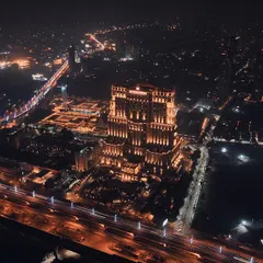
Cinematic City Skyline Aerial Photography
Urban Pulse: City Aerial Cinematography
 20
20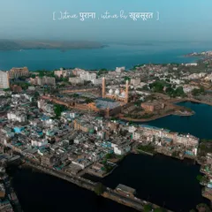
Cinematic Drone Cinematography & Aerial Videography
Cinematic Cityscapes & Urban Drone Videography
Urban Landscape Photography & Aerial Cityscapes
 21
21
Aerial Drone Photography and Videography in Delhi
More from Real Estate & Architectural Drone Videography by Santosh
More services by Santosh