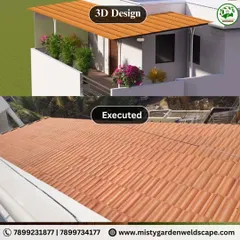
Master Planning & 3D Layout Visualization
Don't guess what your plot will look like. We map out roads, green spaces, and entryways in 3D so you see the final layout before we even break ground.
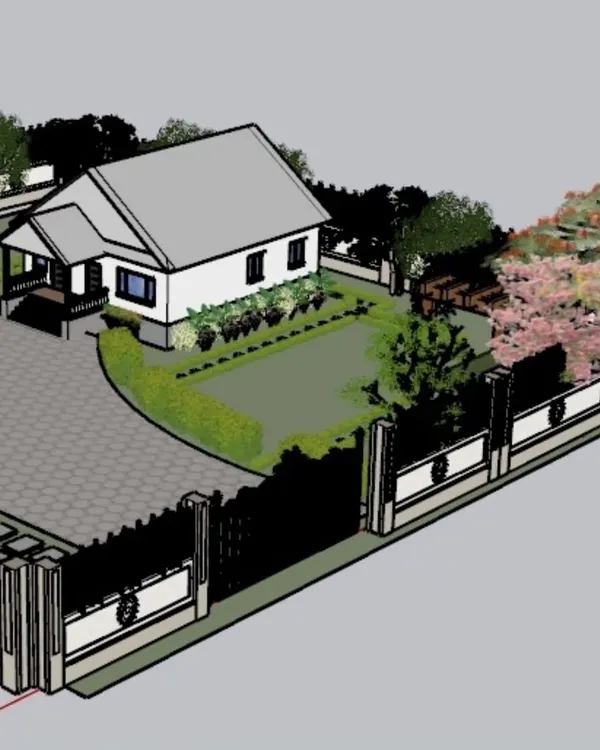
A 3D render of the proposed main entrance for a gated community in Dodbalapur. This design establishes a secure and impressive entry point for the entire layout.
A 3D render of the proposed main entrance for a gated community in Dodbalapur. This design establishes a secure and impressive entry point for the entire layout.
This perspective render shows the main access road, complete with a central green median, sidewalks, and street lighting. It helps visualize the future streetscape of the development.
This perspective render shows the main access road, complete with a central green median, sidewalks, and street lighting. It helps visualize the future streetscape of the development.
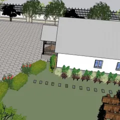
A detailed view of the road design, showing the blacktop surface, painted kerbstones, and paver block footpaths. This level of detail ensures all elements work together.
A detailed view of the road design, showing the blacktop surface, painted kerbstones, and paver block footpaths. This level of detail ensures all elements work together.
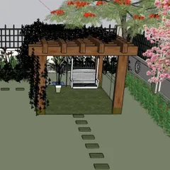
This visualization showcases the road-side landscaping, including raised planters and streetlights, set against the natural backdrop of the surrounding hills.
This visualization showcases the road-side landscaping, including raised planters and streetlights, set against the natural backdrop of the surrounding hills.
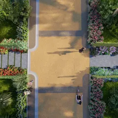
A top-down schematic view used for master planning. This angle is crucial for finalizing the layout of roads, intersections, and amenity spacing for optimal flow and function.
A top-down schematic view used for master planning. This angle is crucial for finalizing the layout of roads, intersections, and amenity spacing for optimal flow and function.
About Project Design & Visualization
Before you put a single machine on your site, you need a blueprint that actually accounts for slope, drainage, and road width. Most people skip the detailed master planning phase, but that is exactly where cost overruns start. When we model your project in 3D, we check if the drainage lines will clash with your entrance or if the road width is practical for heavy traffic. It is about catching expensive mistakes on a screen instead of on the muddy ground.
Why Plan Before You Build?
It is tempting to just clear the land and start digging, but raw land is unforgiving. My 3D visualization process for layouts is not just for show; it is an engineering tool. When we design your gated community or farmhouse layout, we map out the topography, plot orientation, and natural drainage patterns early.
What Goes Into the Plan
We look at the big picture so your investment pays off:
- Entrance Dynamics: We design the main gate and security zone to handle actual vehicle flow, ensuring it is functional as well as impressive.
- Road Networks: Whether it is a 30ft or 60ft road, we ensure the gradation is correct to prevent water logging in the future.
- Green Corridors: Aranyam means nature, so we integrate native planting along roadsides and median strips, visualizing exactly how they will look as they mature.
- Utility Planning: Electrical poles, street lighting, and underground drainage routes are all finalized here so we do not have to break your newly paved roads later to lay a missing cable.
By the time we move to the construction phase, you will not be guessing what the final project will look like. You will have a clear, realistic roadmap. If you are developing land in Hyderabad or Bangalore, let us sit down with your site survey and map out a layout that stands the test of time.
Similar work from other experts
Browse through Curated picks from other experts on mytribe
Conceptual Landscape Designs & 3D Visualizations in Bangalore
3D Architectural Design & Home Visualization
 8
8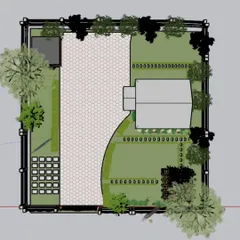
3D Garden Design and Landscape Planning
 6
6
Architectural Home Design and 3D Planning
 6
6
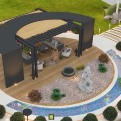
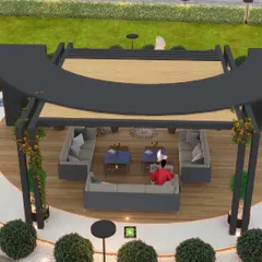
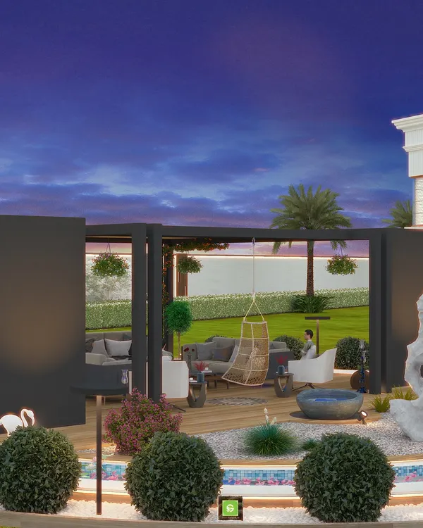
3D Landscape Design & Visualization Services
Visualize Your Outdoor Space Before You Build
Looking for other development services?
You can search for specific site development needs or infrastructure projects below.
More from Turnkey Land & Infrastructure Development by Aranyam Landscape
More services by Aranyam Landscape